London Orbital Rail
London Orbital Rail: linking London's railways and airports
An elevated light railway along the M25, M23, M1 and M11, connecting London's railways and airports to each other. Conceived in the 1990s.
The idea
Change lines without coming into London
The project was conceived in the 1990s, when the route for HS1 was being debated. At first it was seen simply as a means of linking together all the railway lines coming into, and out of, London, so that passengers need not come into central London to change between one line and another. That would be convenient, and it would reduce congestion on existing trains and on the Underground.
Given the poor connectivity of airports, airline pilot Peter Buckley proposed that the project should also link not just Heathrow, already on the M25, but London's other airports, to the railways and to each other, using the M23, M1 and M11 as well as the M25 corridors, with an elevated light rail similar to Skytrain in Vancouver or the DLR in London. ITSL Consultancy Ltd was formed to take the project forward; it was first known as LARTS, the London Air Rail Transit System.
Why elevated, and why sustainable
Brown land along the motorway margins
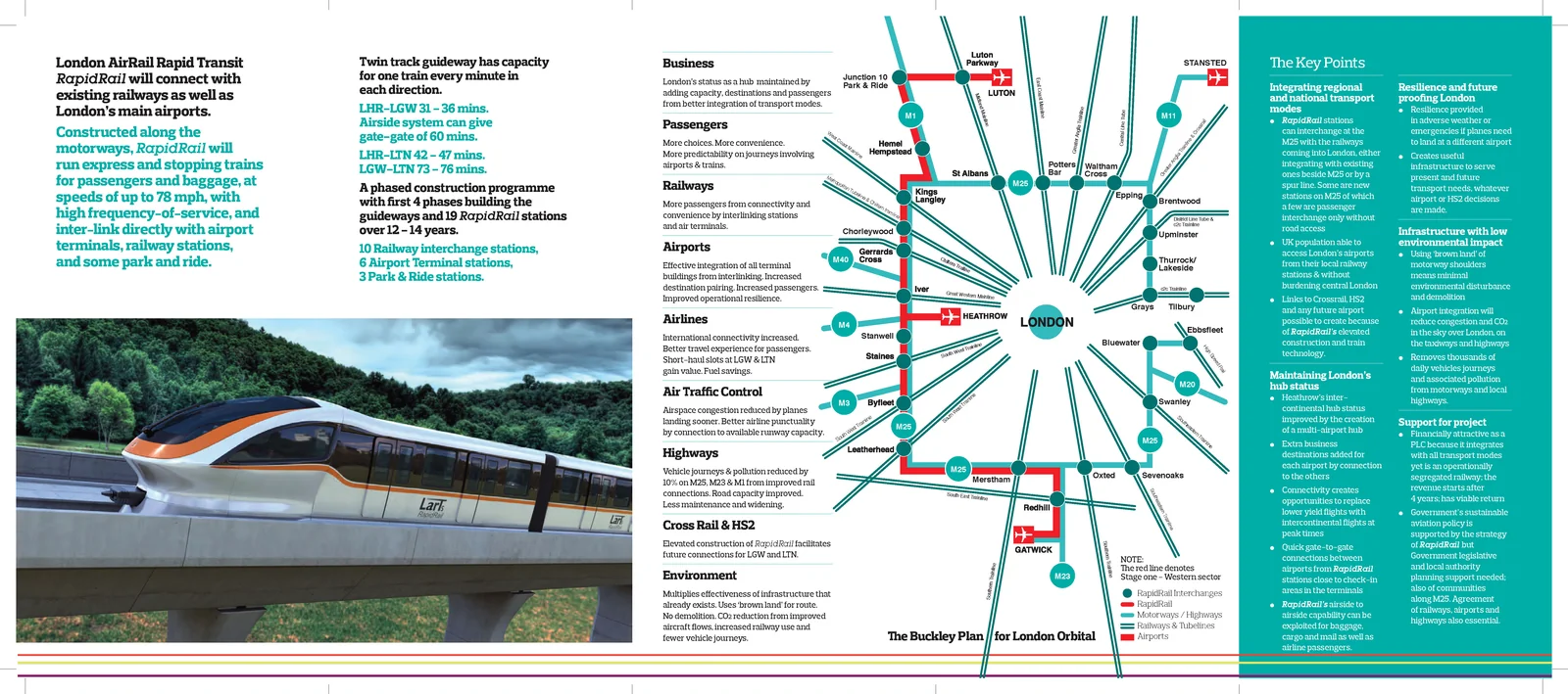
The route uses 'brown land' along the spare margin of the M25, M23, M1 and M11: it avoids 'green' land, uses routes that are already polluted and noisy, and avoids any demolition of existing buildings.
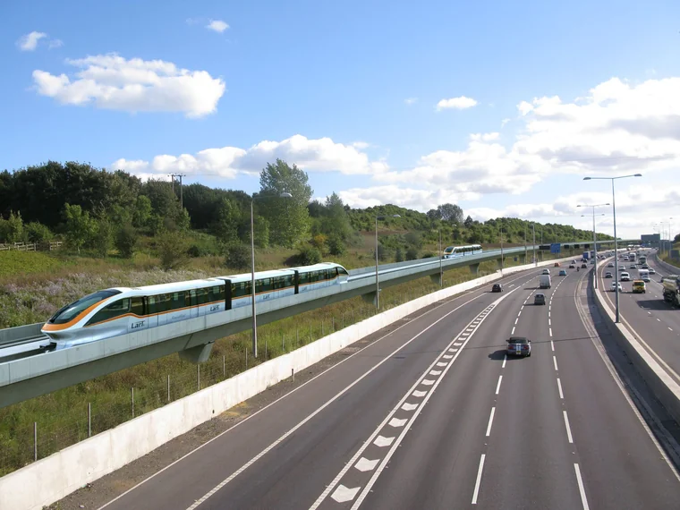
Being elevated lets the system negotiate obstacles, and in particular cross a motorway like the M25 where widening has removed the 10m margin that was once on either side. It also lets the light rail connect with existing stations by sitting above them, or alongside them where there is space, so the system is totally separate from, and does not interfere with, the existing railway lines.
The railway would substantially reduce the number of vehicles, and the pollution, on the western sector of the M25.
Phases
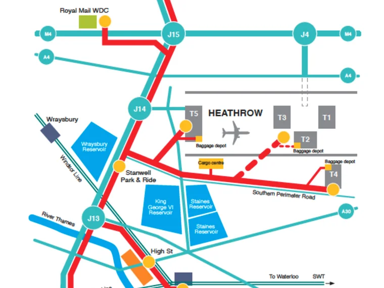
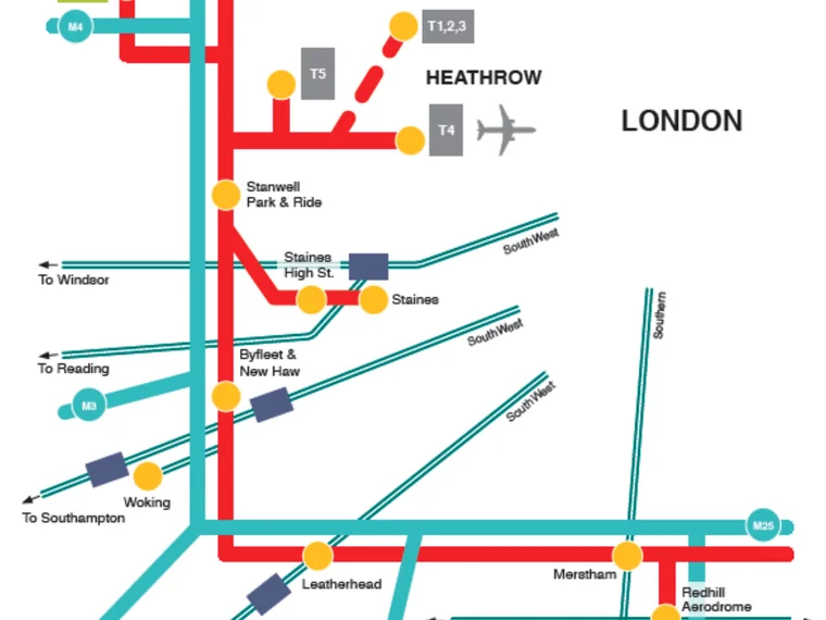
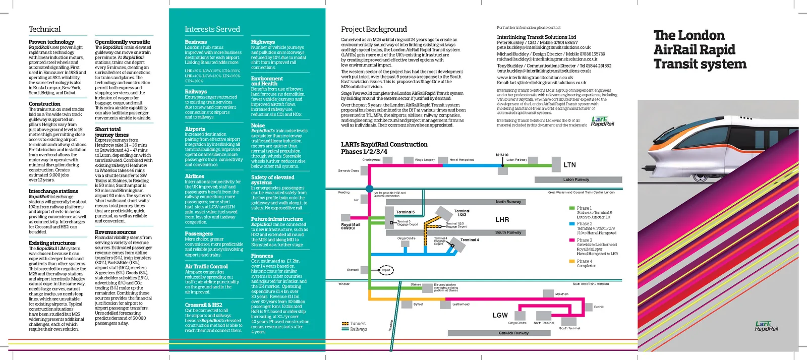
Built in stages, from Staines outwards
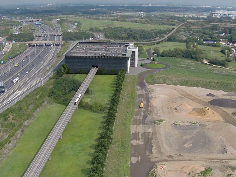
Phase One has been supported by Spelthorne Borough Council as a means of helping regenerate Staines.
SLR, Phase One: Waterloo to Heathrow via Staines
Southern Light Rail links Waterloo to Heathrow with a spur off the main M25 route to Staines-upon-Thames. Journey time 7 minutes, on a train every 6 minutes during the day and less often after 11pm.
Heathrow to Gatwick express
The next phase creates a 31-minute express connection between Heathrow and Gatwick, four times an hour, with a stopping service for the stations in between.
The full orbit
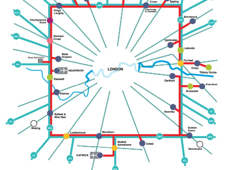
Connecting London's railways, airports and major highways to each other, with park and ride and bus hubs where the motorways and main A roads join the M25.
Journey times from Heathrow Terminal 5
The stations that can be connected, and the total journey time to each from T5.
| To | Time |
|---|---|
| Gatwick Airport | 31 mins |
| Luton Airport | 32 mins |
| Stansted | 57 mins * |
| Southend Airport | 59 mins |
* Light rail from T5 to Waltham Cross, then change onto the Stansted Express.
| To | Time |
|---|---|
| Staines | 7 mins |
| Byfleet & New Haw | 11 mins |
| Leatherhead | 24 mins |
| Merstham | 31 mins |
| Oxted | 38 mins |
| Sevenoaks (Dunton Green) | 47 mins |
| Swanley | 60 mins |
| Dartford | 66 mins |
| Bluewater | 54 mins |
| Ebbsfleet | 57 mins |
| Iver | 6 mins |
| Kings Langley | 19 mins |
| Potters Bar | 32 mins |
| Waltham Cross | 38 mins |
| Brentwood | 52 mins |
| Upminster | 56 mins |
| Lakeside | 62 mins |
| West Thurrock | 64 mins |
| Grays | 67 mins |
| Tilbury | 69 mins |
Automated, 24 hours
Passengers by day, air freight by night
The elevated light rail will be fully automated and would run 24 hours a day: airport staff and passengers need to travel early and late.
As well as passenger carriages, the system has freight wagons designed to take containers into cargo areas and so into the holds of planes. The freight operation would run mainly at night and at other times when there are fewer passengers.
The route and the guideway
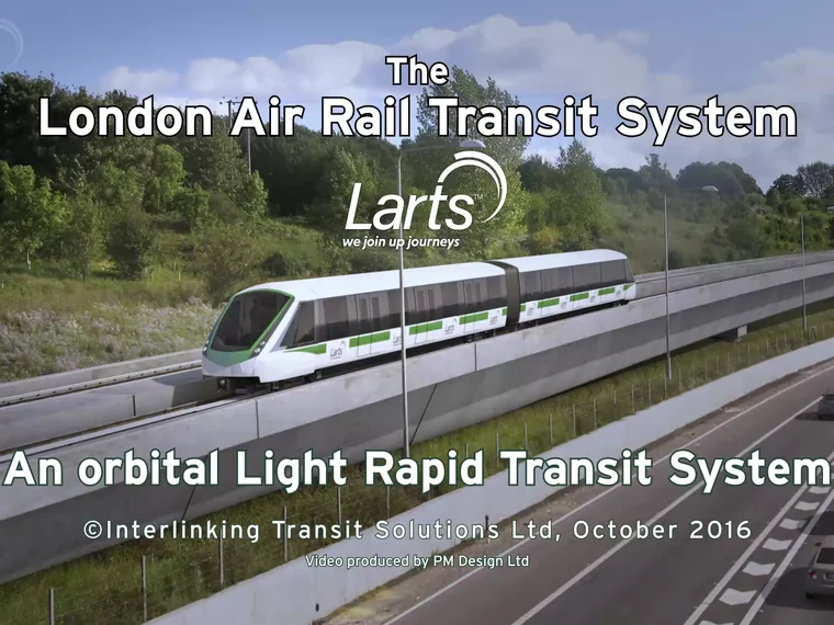
Images of the proposed guideway and routes. The guideway image was created by Olivier Demangel; the Staines to T5 image is by Paul Maynard, who also made the project's 4-minute video.
Where it has been presented
Talks, a leaflet and a video
The elevated light rail has been presented to local authorities, central government, MPs and engineers, transport planners, lawyers and property companies.
Having written the text, we commissioned a five-page fold-out leaflet on the proposal from the graphic designers Small Back Room. A 4-minute video by Paul Maynard shows the proposed guideway along the margin of the M25, with two three-carriage trains about to pass.
Get in touch
Interested in the project?
Email Michael Buckley to ask about London Orbital Rail, the leaflet or a presentation.
64A White Hart Lane, London SW13 0PZ+44 7838 155739 · envaluation@icloud.com